Community
4 April, 2025
Historic map on show
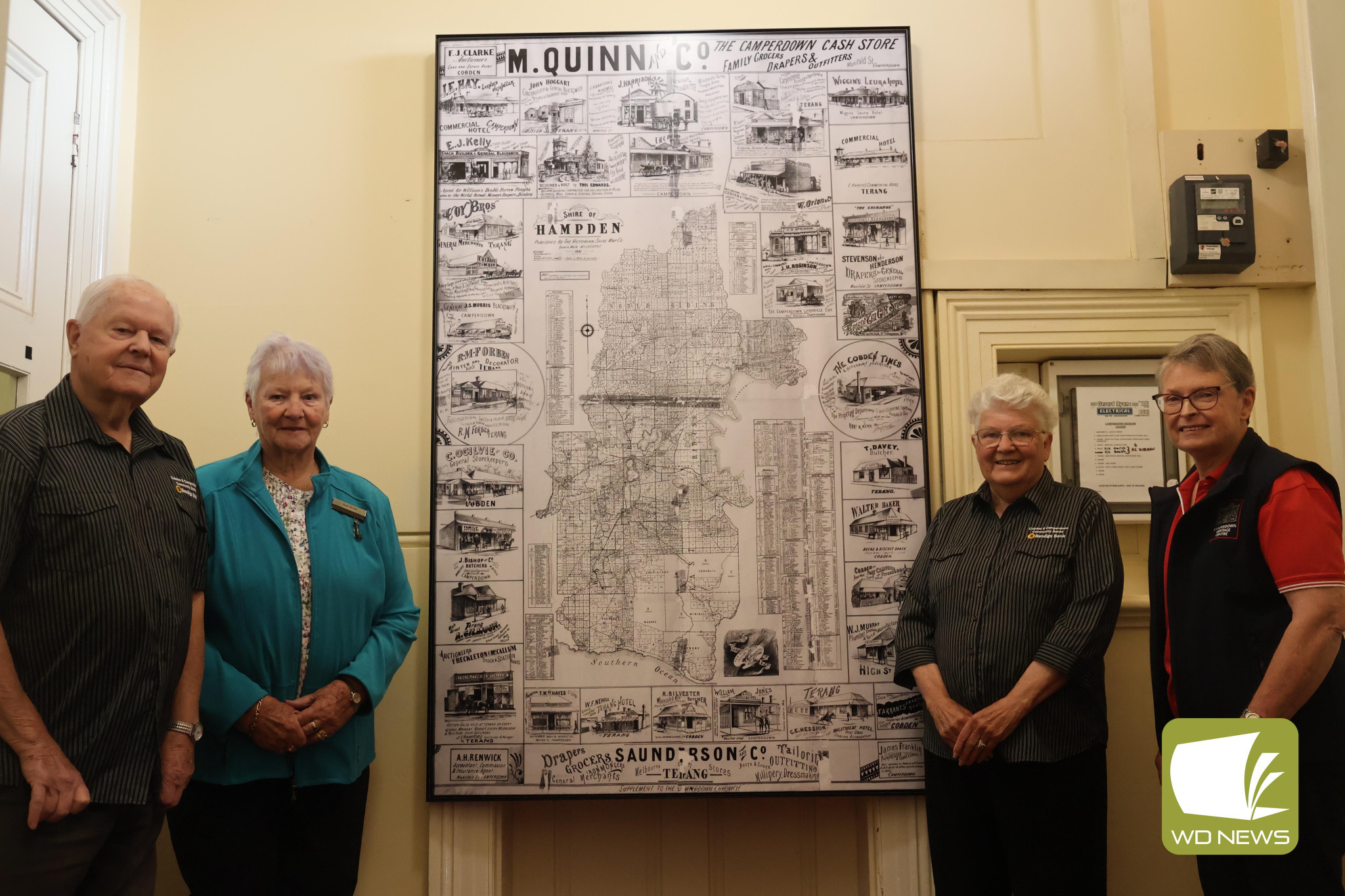
CAMPERDOWN and District Historical Society (CDHS) has recently unveiled the newest addition to its collection – a reproduction of a map of the Shire of Hampden from 1891.

The reproduction is a print onto metal of the original map, which is held in the Corangamite Shire Council offices on Manifold Street and was unveiled on Tuesday to representatives from the Cobden and Camperdown Community Banks.
The map covers from Skipton in the north and south to the coast, with numbered rural allotments, an index of the names of the owners in each parish (as at 1891), their allotment numbers and total of acres they held.
Around the outside edges of the map are historic adverts (lithographs) of many businesses in the shire along with a description of their goods.
A sponsorship of $1500 was provided to the CDHS by the Community Bank to assist in covering the expenses associated with printing the reproduction.
CDHS secretary Maree Belyea said the society received permission from Corangamite Shire Council chief executive officer David Rae to have the original map photographed by professional photographer Glenn Wilson, with the individual photos ‘stitched’ together into a digital copy.
“The electronic copy is very useful when zoomed in, however, to fully use and understand the resource we needed to have it printed – 1210mm by 1910mm,” she said.
“This allows the map and parish index portions – the parish map and its index are often quite a distance apart – to be viewed at the same time and to provide a full overview.
“We investigated various options for reproduction, including printing onto archival paper and cotton products, then mounting and framing behind glass.
“This option would have resulted in a very heavy item with very little options of moving, and the risk of the mounting product leaching into the print.
“The recommended backing product is not available in the size we needed the print to enable the detail to be easily read.”
The reproduction is printed on a metal with a matt finish which is non-reflective and lightweight, allowing for ease of movement for relocation if required, and has an art frame box to protect the map.
“Print2Metal guarantee their product to last a minimum of 65 years indoors, but with our conditions and not in direct light, the lifespan will be much longer,” Mrs Belyea said.
“Glenn Wilson provided the files and liaised directly with the printers to ensure the best result possible was achieved.
“The finished product is not only an excellent historical display piece for our society but one of great use for all researchers and also the six other historical societies within Corangamite Shire covered by the map.
“The map is an amazing snapshot of that period and a great historical resource.
“We also intend offering the electronic version to our fellow societies in Corangamite Shire.”
CDHS vice president Bob Lambell spoke at the unveiling, expressing his gratitude to Mr Wilson for his work in replicating the original map through photography.
“It’s bigger than the original located at the Corangamite Shire offices, and on the computer, it can be enlarged,” he said.
“It will be a wonderful resource.
“I’d like to acknowledge the work of Maree Belyea, who put all this work together and brought it to fruition, and our sponsors the Bendigo Bank – it wouldn’t be possible without their funding.”
Cobden and Camperdown Community Banks representative Pat Robertson congratulated CDHS and those involved in the process.
“This historical society seem to be miles ahead of what everyone else is doing in the area,” she said.
“I feel really privileged to have the opportunity to support such enthusiastic people that put so much effort into our community.
“It’s really great you’ve done this – it looks fantastic.
“Congratulations to everyone and, from our point of view, it’s been money very well-spent.”
Read More: Camperdown